Why are we driving past the lake? It looks huge! It must be Issy-Kul. Hey, let me have the map, there is no way we should go past the lake. It’s in the other direction! Ask the guy where we are going.
On the road
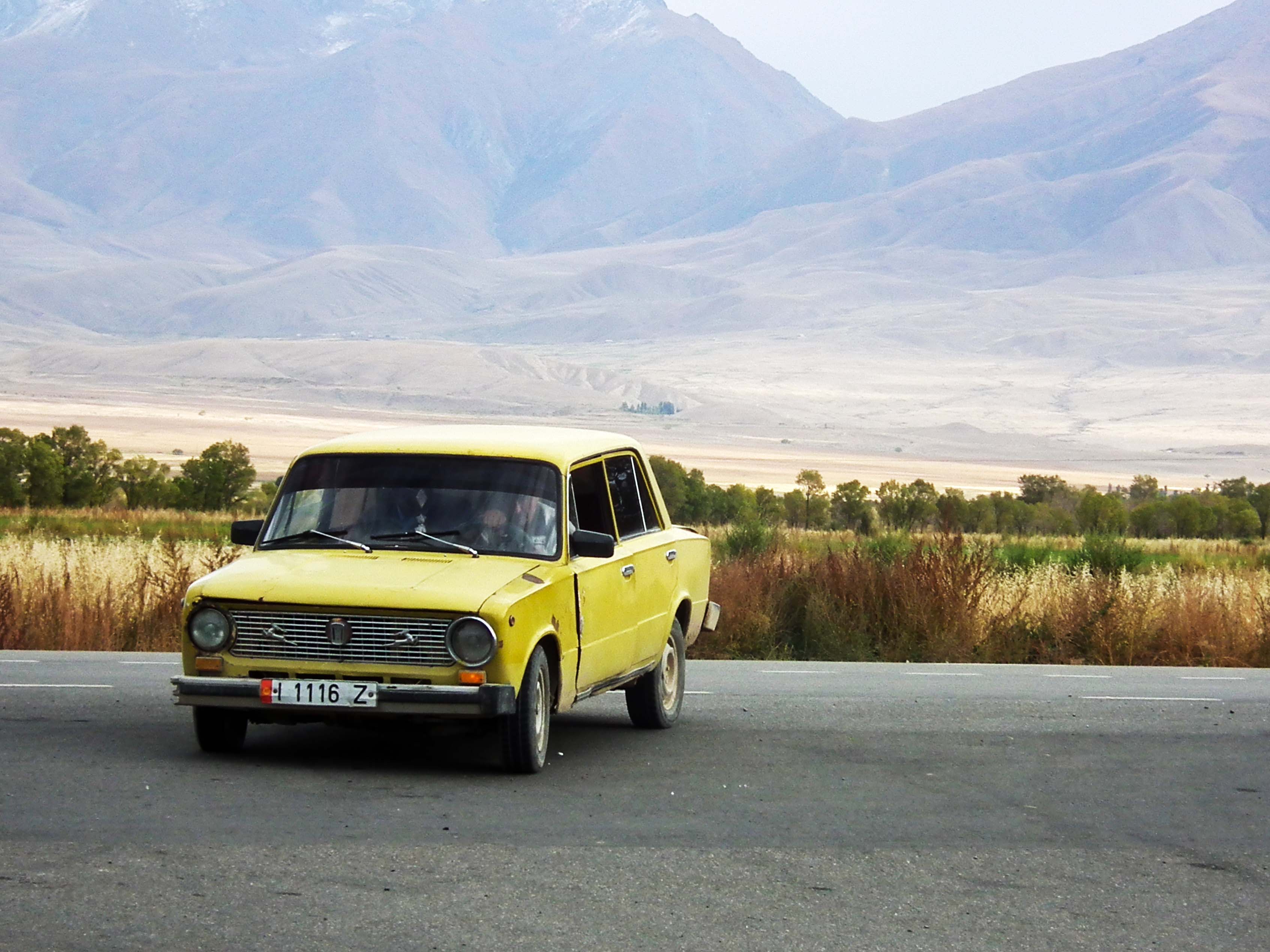
Or something along those lines. We had got to the taxi-marshrutka station, and after asking about and haggling some more, had got on a shared taxi towards Koch Kor and eventually Naryn or Song Kol. Or so we though, as by halfway along the journey as I woke up from a nap I realised there was no way this was the right road. No we weren’t being abducted, it just turns out that Koch Kor sounds remarkably like Koch Kol, a tiny village on the north bank of Issy Kul. Was this due to our appalling accents? I have no doubt. That being said the guy at the station was probably quite happy to pocket our cash and see us off. The actual driver who didn’t speak a word of English was slightly horrified, and kindly took us on the last few kilometres to Chalpon-Ata for free, the largest city on the north bank. Having already advanced a fair amount towards the east, and not really wanting to backtrack we had lunch and managed to find a marshrutka towards Karakol. This was our first experience on the shared transport. I’d been in cramped transport in Cambodia, but this was different: the actual mini-bus is a fair size; it’s just the amount of people that get in that makes it small. Initially around 10 of us, several stops later we were at least double that number. Kids don’t exist. They either go on someone’s lap or squeezed into a corner. It wasn’t much better for the late arrivals, as they stood up in the spaces between seats or next to the door. Money is passed up via the passengers and change handed back down, apparently with total honesty by all. Luckily we had just got on before a small rush and having seats it was a pleasant journey to Karakol, the lake on one side and the mountains on the other. As we headed south we could see the slopes of the Central Tien Shan getting closer.
Although some of the late preparations had been a bit of a rush, this was the part of the trip that I’d looked at the most. The mountains south-east of Karakol are the highest, with peak Jengish Chokusu, also known as Peak Pobedy, going all the way up to 7439 m. Not knowing if we would be able to get close the Chinese border due to permits, we had also planned some trips into the mountains just south of Karakol, the smaller Ala-Too range, with several peaks in the 5000s.
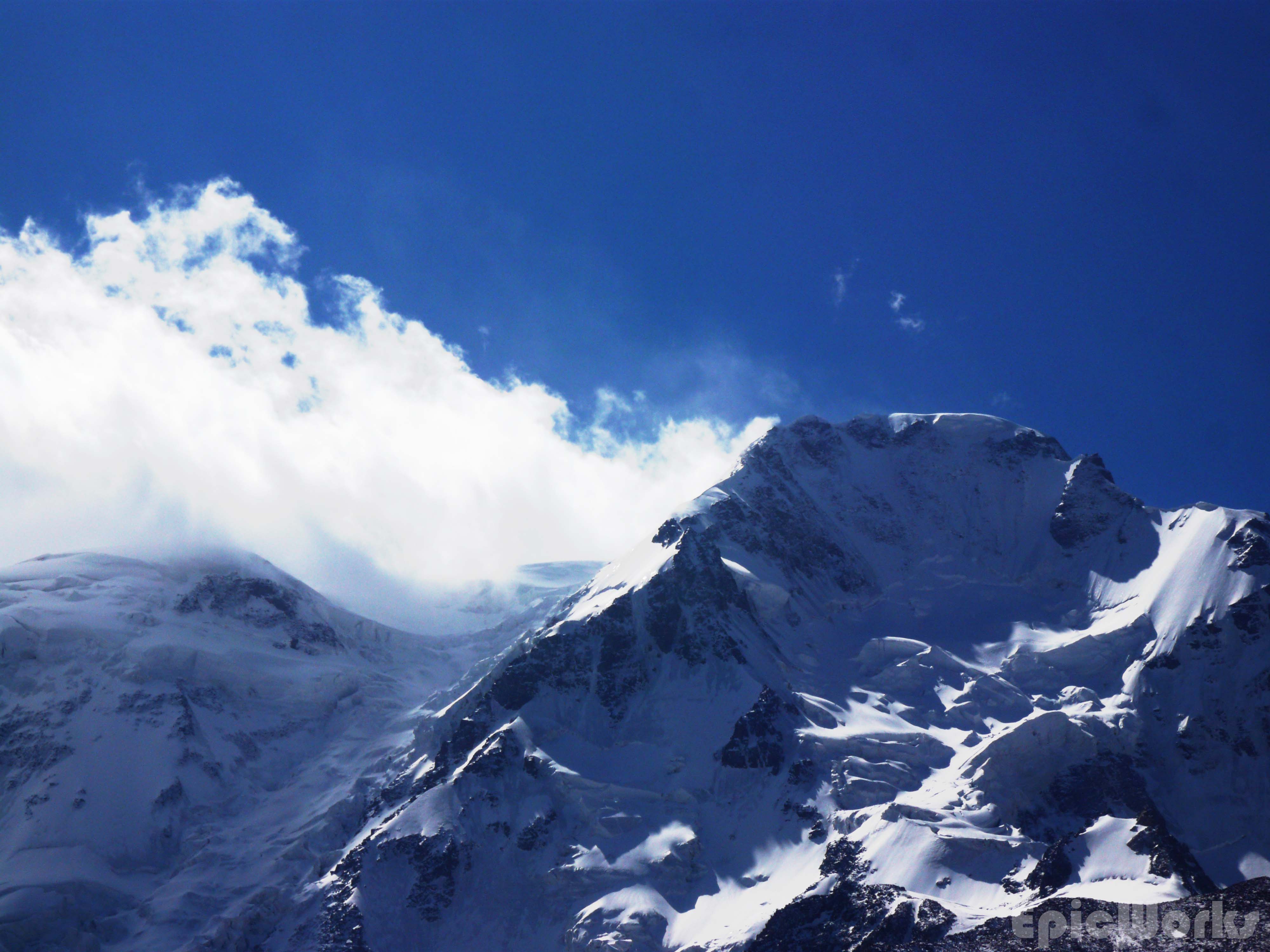
Ala-Too range touching the sky.
Karakol is considered the hiking and mountain tourism city of Kyrgyzstan, having been called the Chamonix of the Tien Shan. What can I say? No. No it’s not. The middle sized town is basically unpaved streets with lines of house behind very high walls. The main street has all the important shops, including supermarket and sport shop (it sells gas!). It is changing fast, with lots of private and public building going on. One of the things I wanted to do this trip was try and found out as much as possible of the logistic possibilities of Karakol for future trips, especially in terms of kit rental, mountain transport and navigation. Luckily as soon as we got there we met an American, Alex, who is working for EcoTrek, one of the hiking companies there. With his help we were able to enquire about the permits, rent some mountain equipment and get lots of interesting information. We also visited the CBT, or Community Based Tourism.
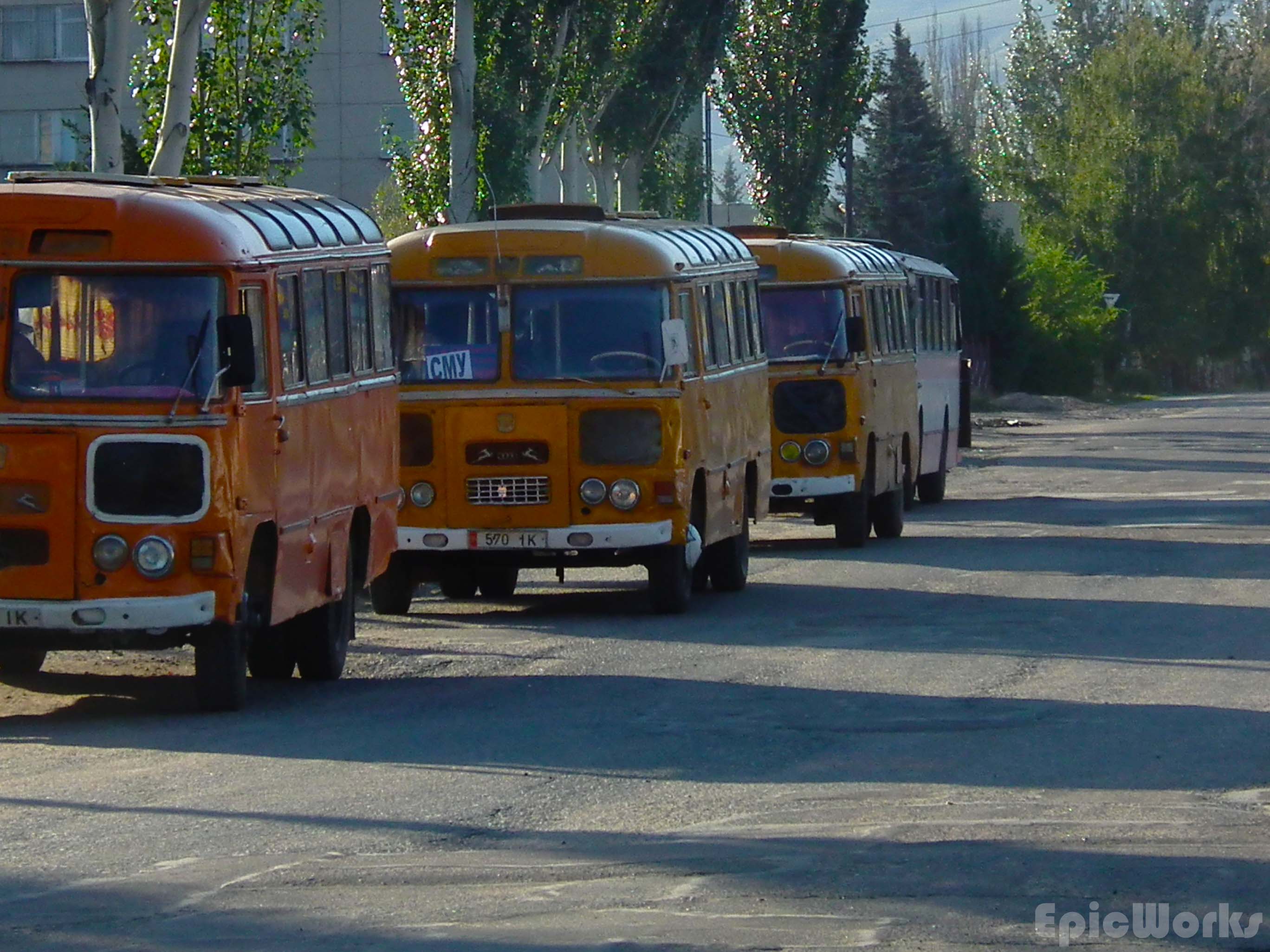
School-buses? Karakol
Green and red. Pobedy Park.
So what were we able to find out? The permit for being 50 km away or nearer to the Chinese border is now more complicated to obtain and takes 5 working days. We weren’t quoted a price but I don’t thinks it’s too expensive. This did mean that in our case we automatically discounted the possibility of going to the high mountains as we didn’t want to spend so long in that part of the country. For the equipment rental we were referred to Extreme Tour Shop. This is a small house a 5 minutes’ walk from the centre. After having waited for more than 3 hours for the owner to arrive at 8 pm we were able to rent rope, harnesses, ice-axes, crampons, carabineers and ice-screws. The shop is well stocked, especially with alpine skis and also offers some mountain clothes and kit for sale. The equipment we got was old but functional and pretty cheap by western standards. Although some of the companies did have their own kit and could rent some of it, there wasn’t much, and we counted ourselves lucky to find the crampons. I would probably recommend that if you are thinking of doing some serious stuff, bring your own. Finally for the transport, as we didn’t want to spend too much money at this point we decided to go the easy way into national reserve closest to Karakol. To get there you can take the 101 marshrutka and then hike up the trail. This is the way to the touristic Ala-Kol lake, but we were hoping to go past it and continue up the valley to see some of the 5000s and try and explore a bit. The marshrutka costs 10 som and entrance into the park 250 som person + 150 tent.
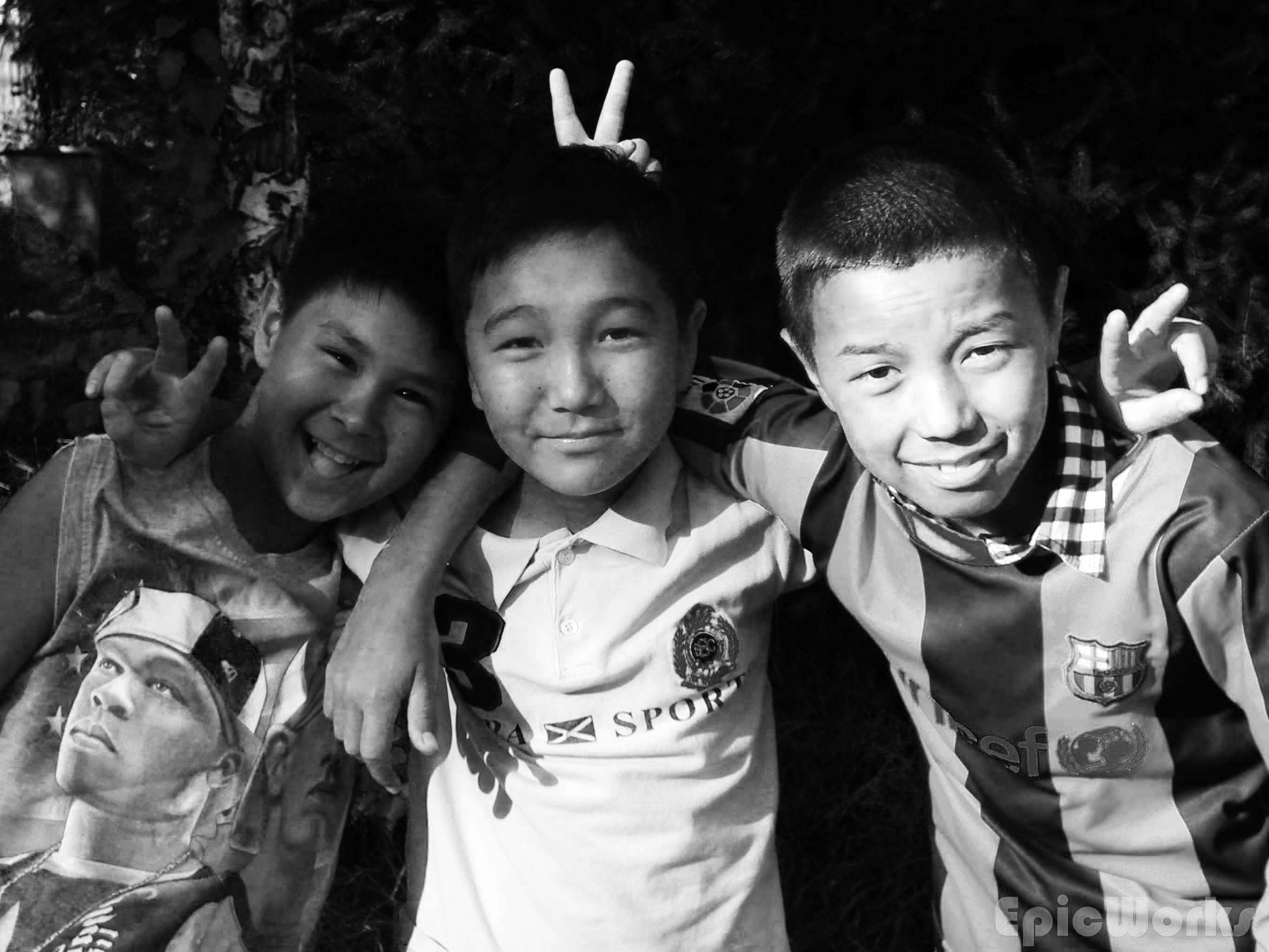
Alex took us around one of the parks were we met some local kids and some girls passing by. The girls kindly bought us some snacks and for the first but not last time we were amazed at these peoples kindness. After, as it was too late to head off so we camped in one of his Soviet’s (a friend of Alex) garden before heading of next day.
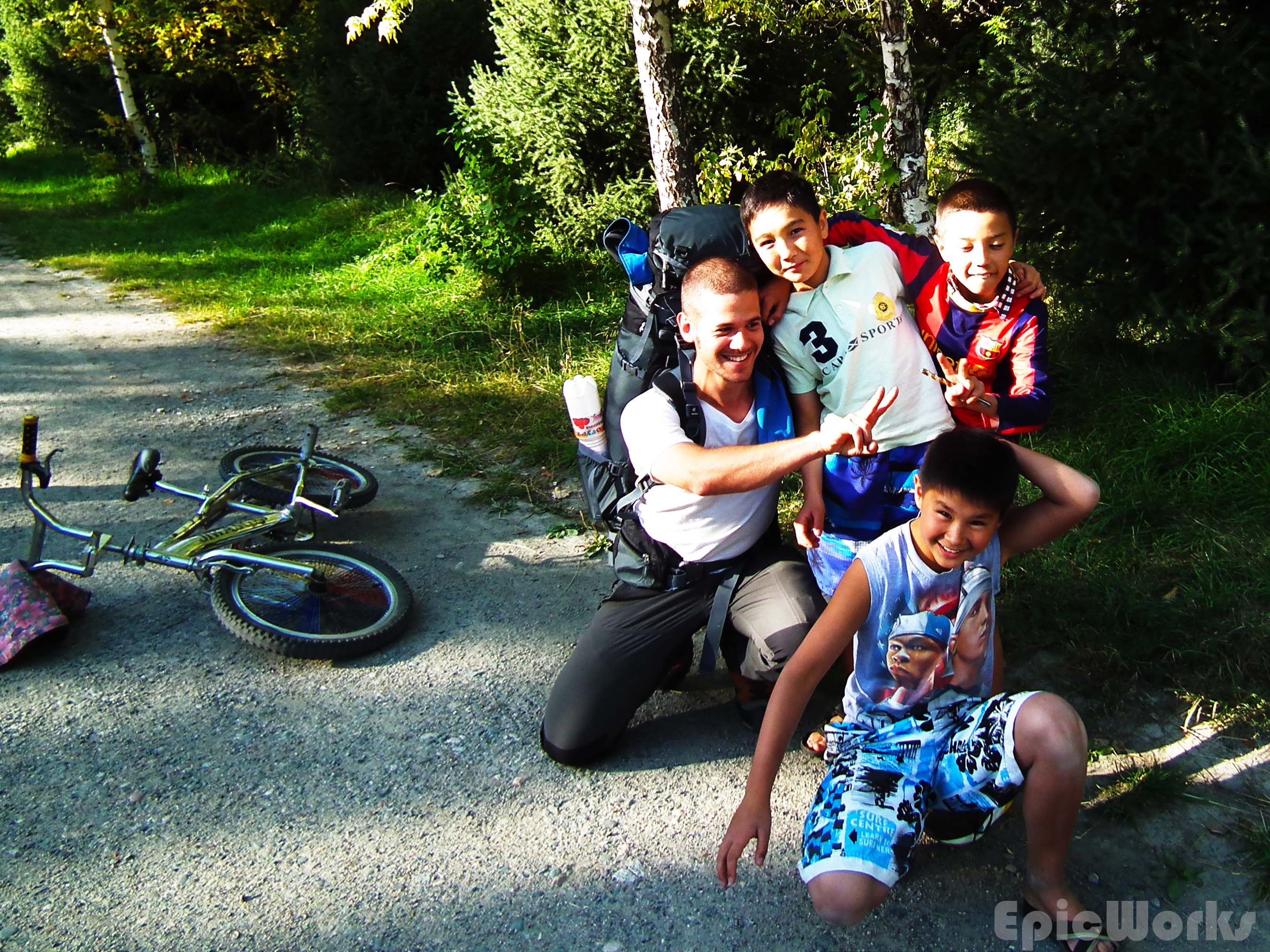
Having fun with the kids
The young ones.
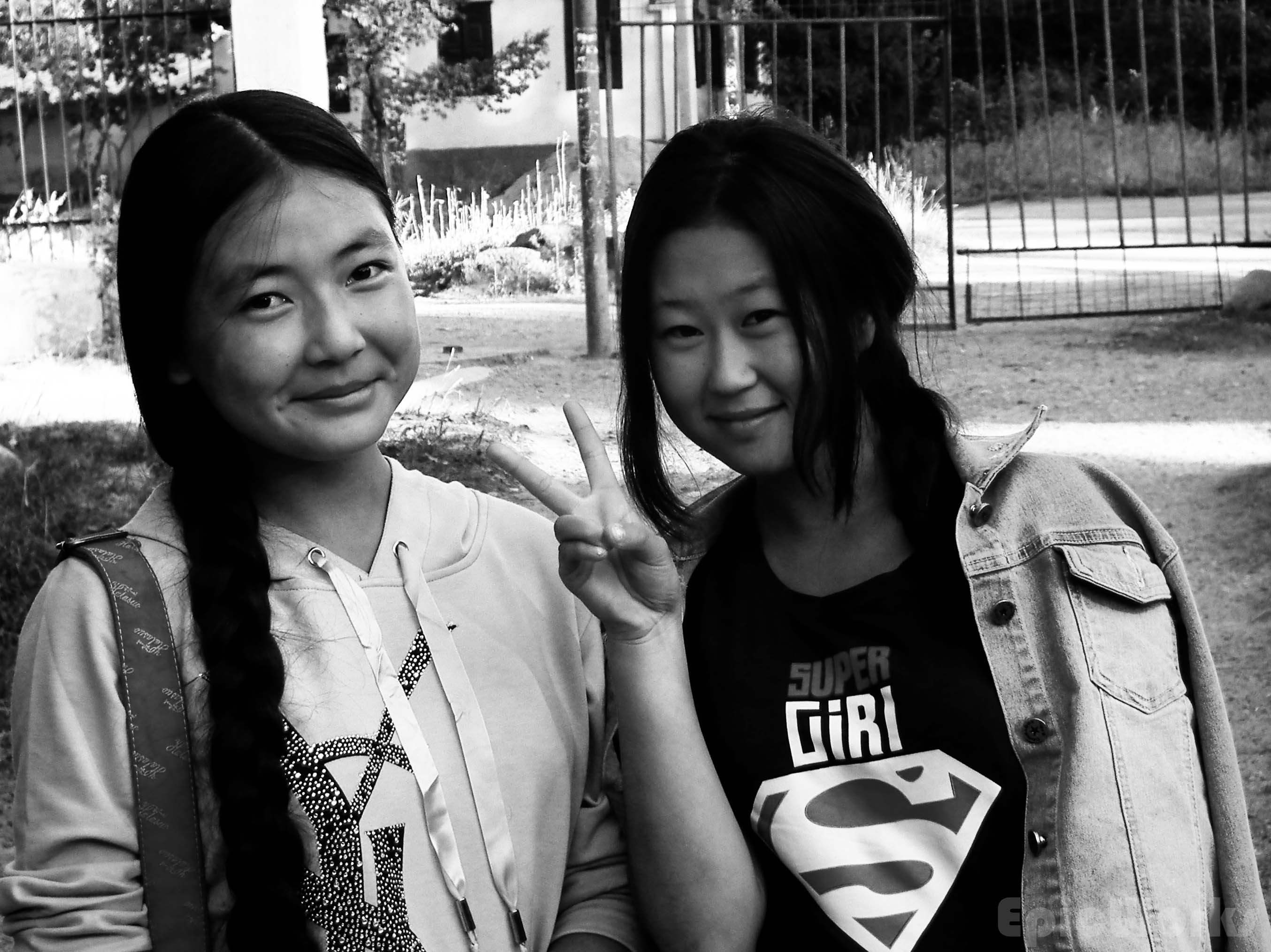
Super-kind
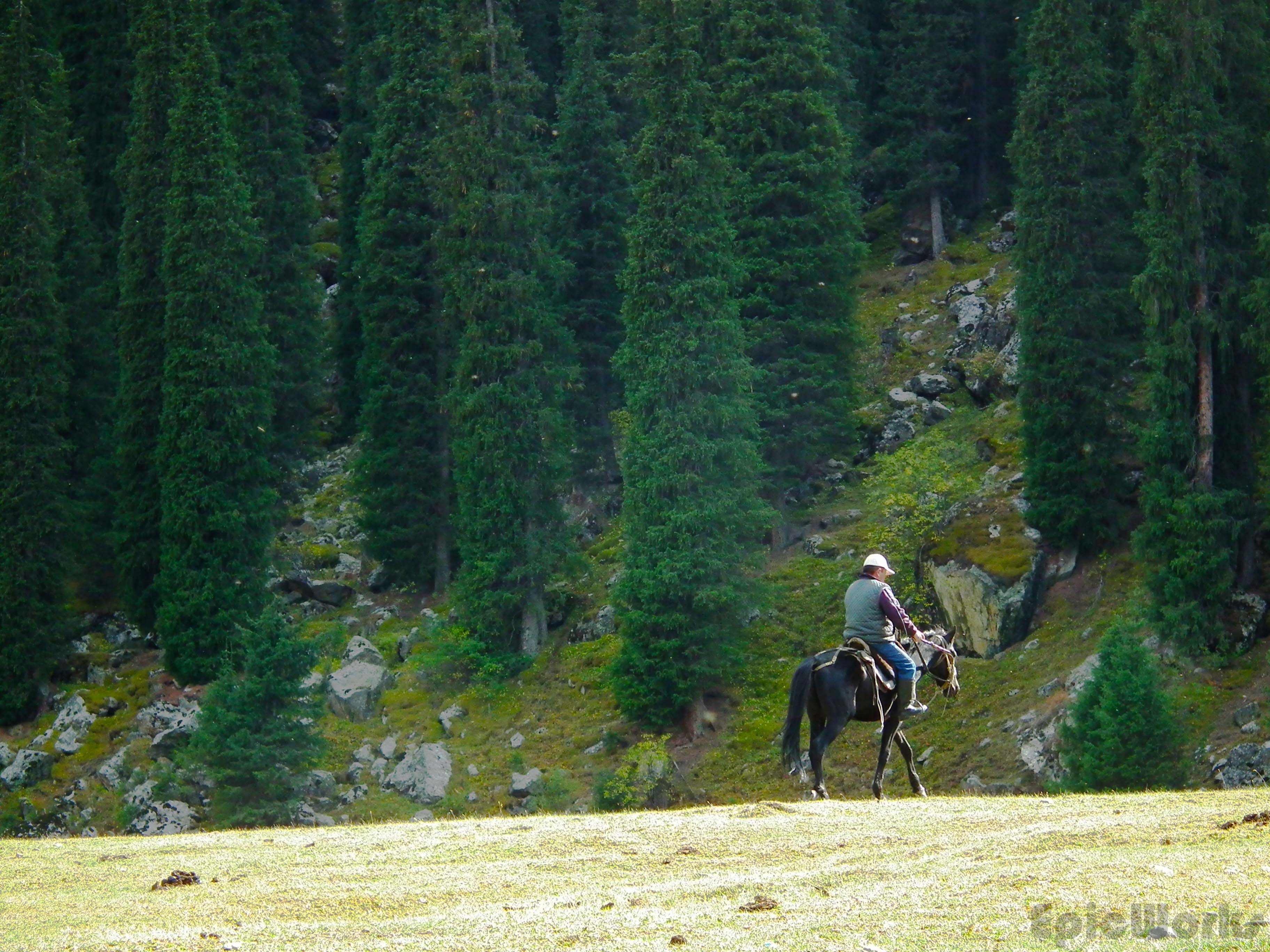
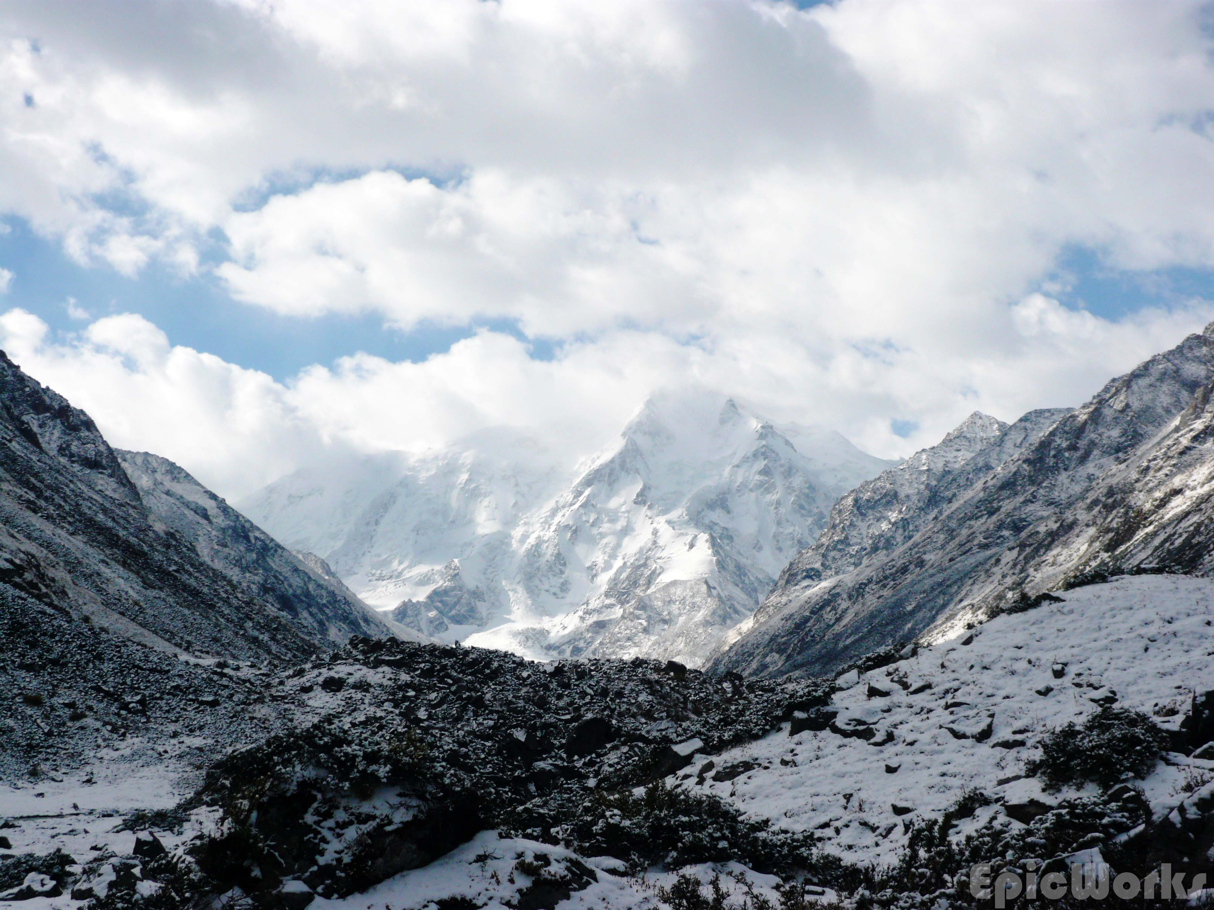
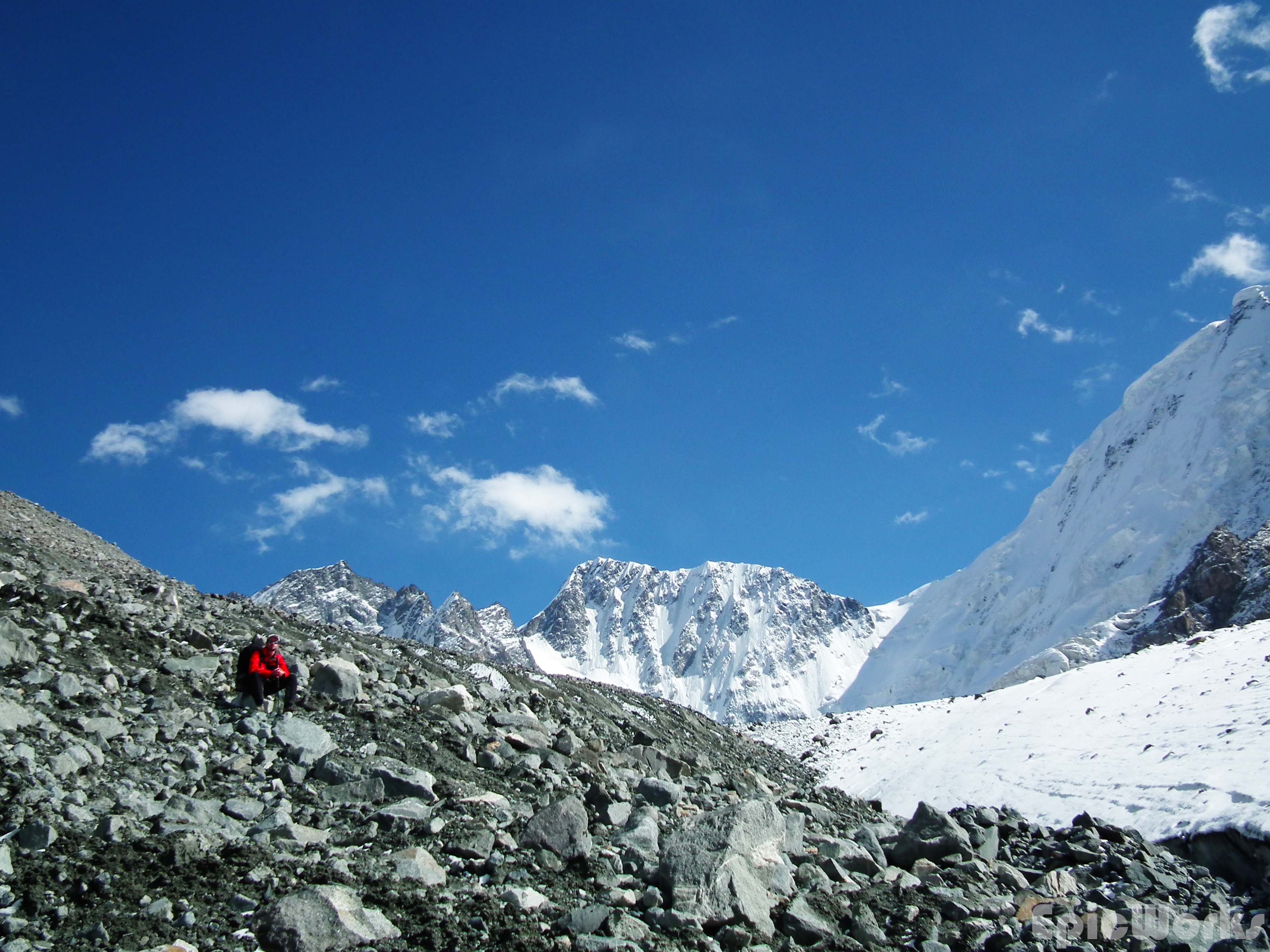
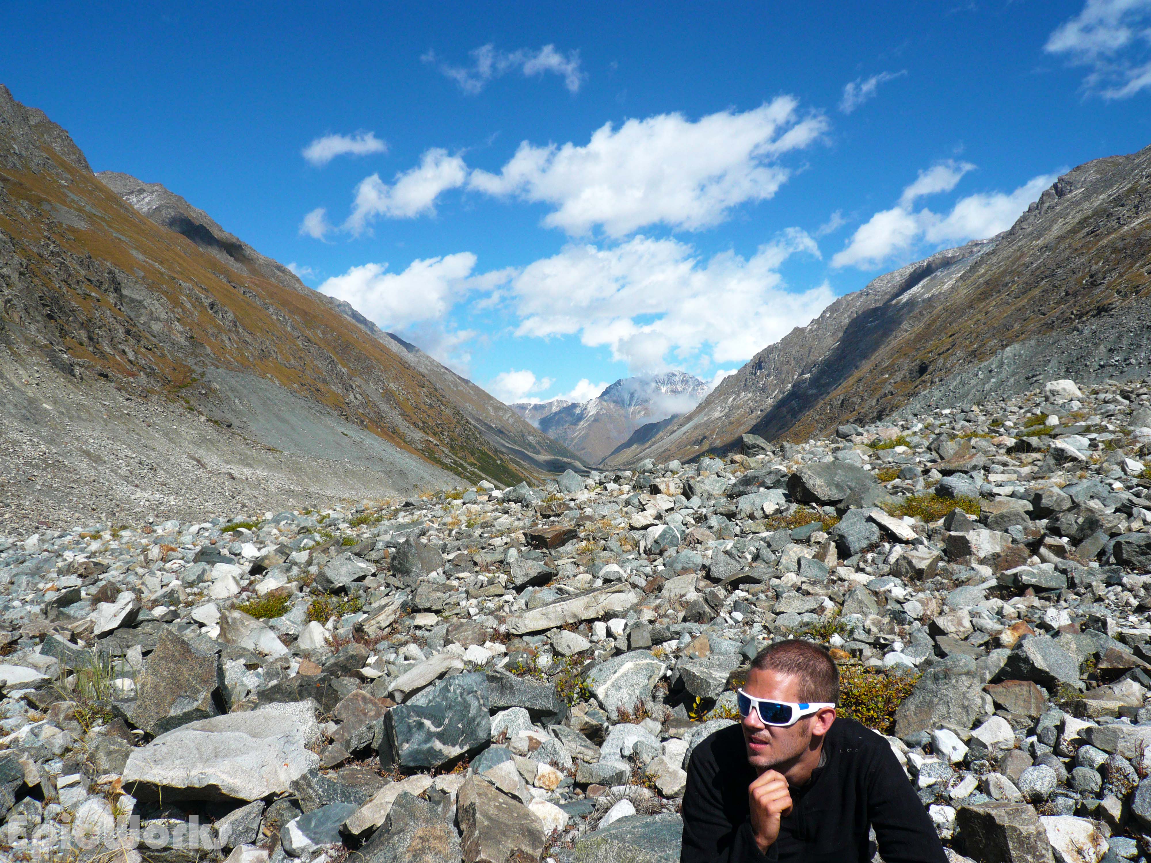
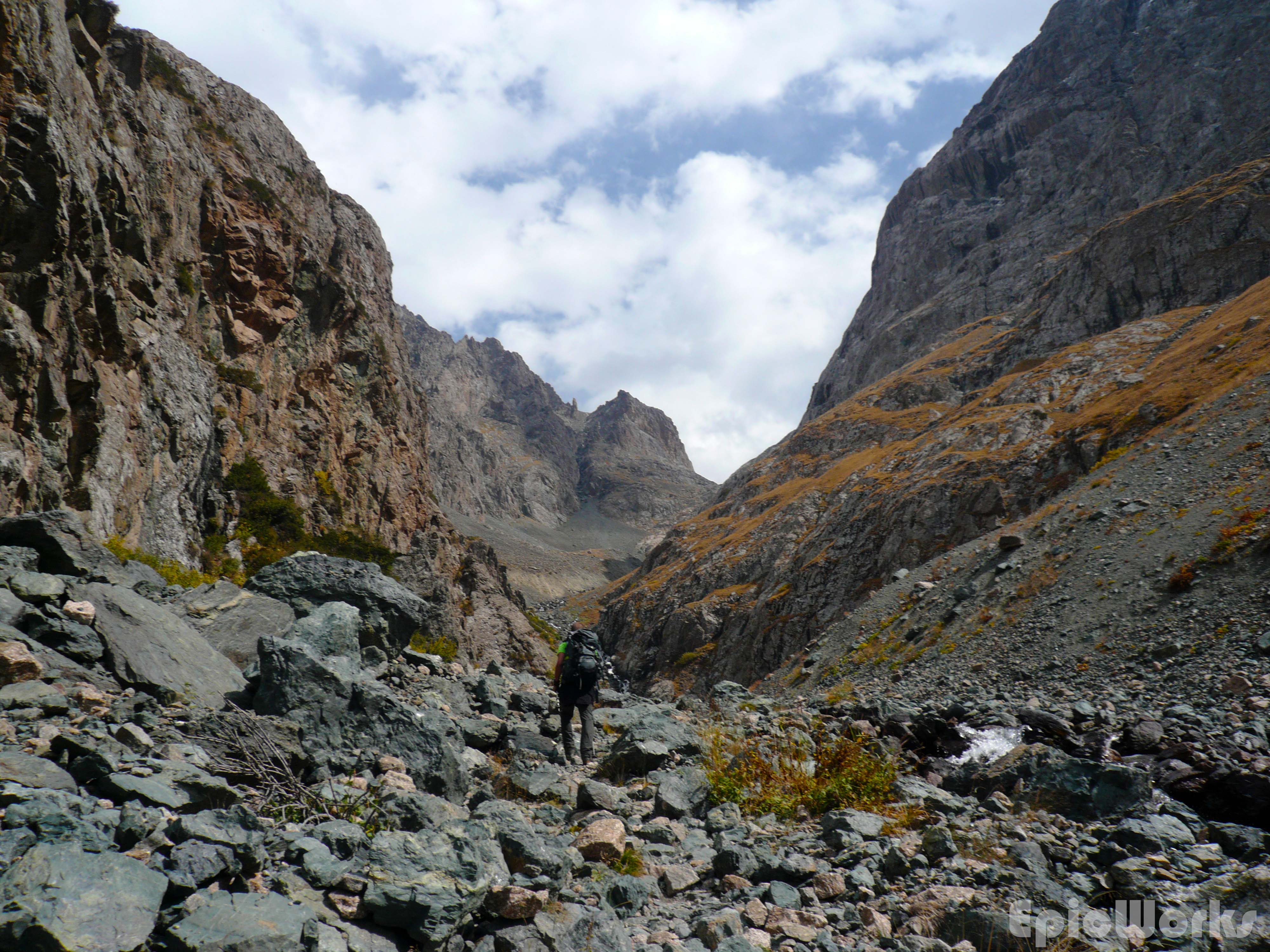
Next day was the first of four we spent in the Ala-Too mountains. After getting of the bus we headed up the valley. After the entrance to the park, we passed a small village and slowly started to gain altitude. Our packs were incredibly heavy, filled with all our stuff for the two weeks plus food and rented mountain equipment. Also, as it was the first few days we still hadn’t got used to the weight. As we left the hot sandy plains the countryside started to evolve, become much greener and slightly steeper. Following the river to a bridge, we changed from left to right bank and kept going up. By this point it was proper mountains, with a more alpine feel, although the peaks we could see where still bare. Although very alpine, there are differences compared to France, such as wider valleys and the green pastures next to the river. We came across several herds of horses grazing by the paths, giving the feeling we weren’t quite in the Alps. After several hours we came to the fork towards Ala-Kol Lake. A small bridge takes you back across the river on the left hand side. We ignored this and kept going up. Our map showed there should still be a path going up a fair distance along the main valley, before it turned away. Thanks to the path we were able to keep going up at good speed. Eventually, as the woods opened out we lost the path. As this was what we expected we decided to keep going up following the river. This was slow work as we had to push through dense plants carrying our backpacks and rope. After some time we came to a small canyon, with a waterfall cutting off our route. As we could see a slight line up above on our right we decide to go that way. We climbed up the steep slope to find, a path! The trail took the logical path above and we were once again gaining altitude. As the day came to an end we were almost at the final stretch of the valley. As the light fell and Thomas started to set the tent up I quickly climbed a few metres higher along the track. As I got to the top of the boulders cutting off my view the hole valley opened up before me. At the end, a massive white peak hit the clouds, the biggest face I’d ever seen. With a thrill of excitement I went back down and got ready for the next day.

Seriously heavy bags! But ready to go.
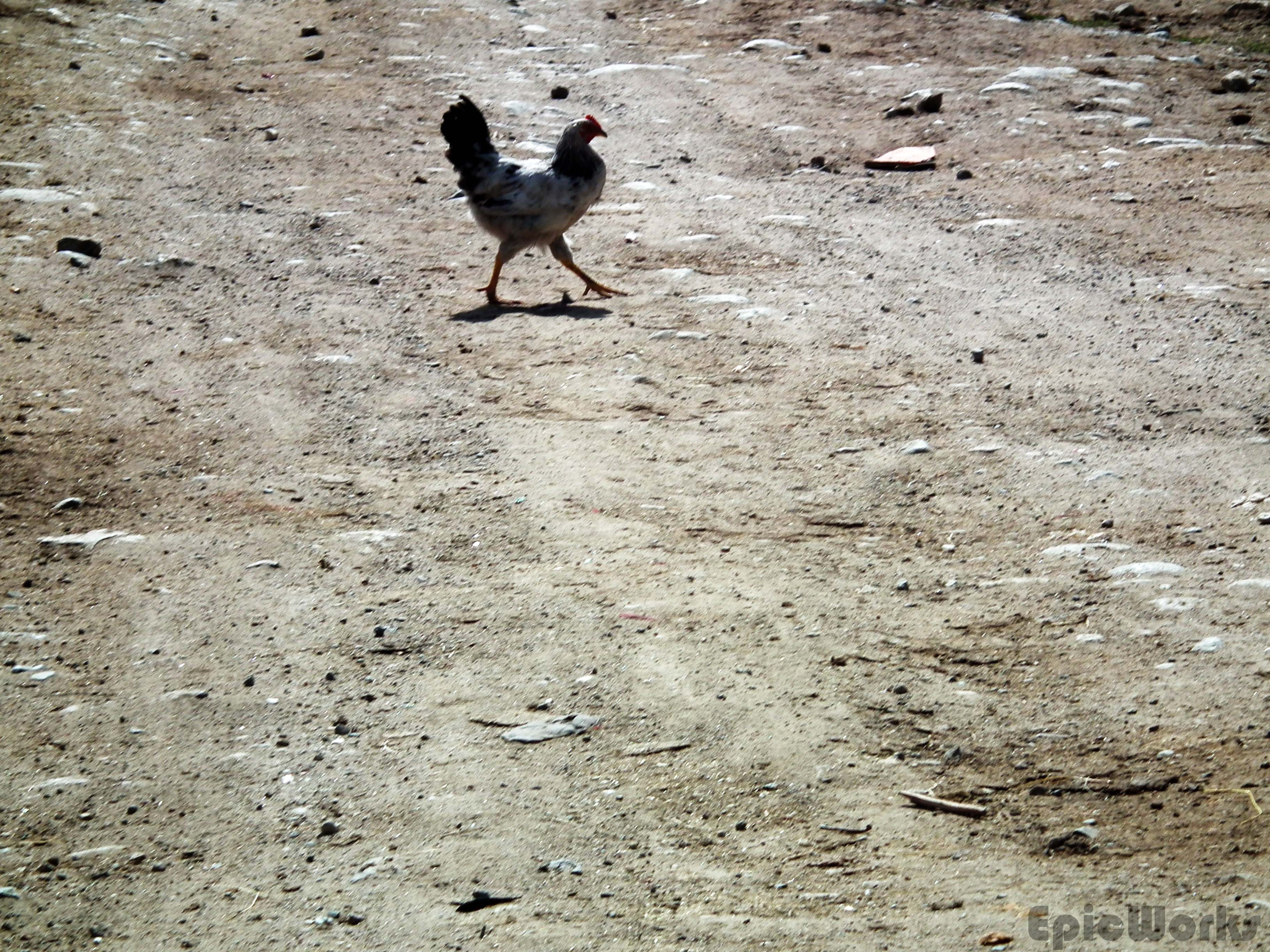
Why did the chicken cross the road?

Definitely not the Alps
It’s them that make the tracks

The white monster.
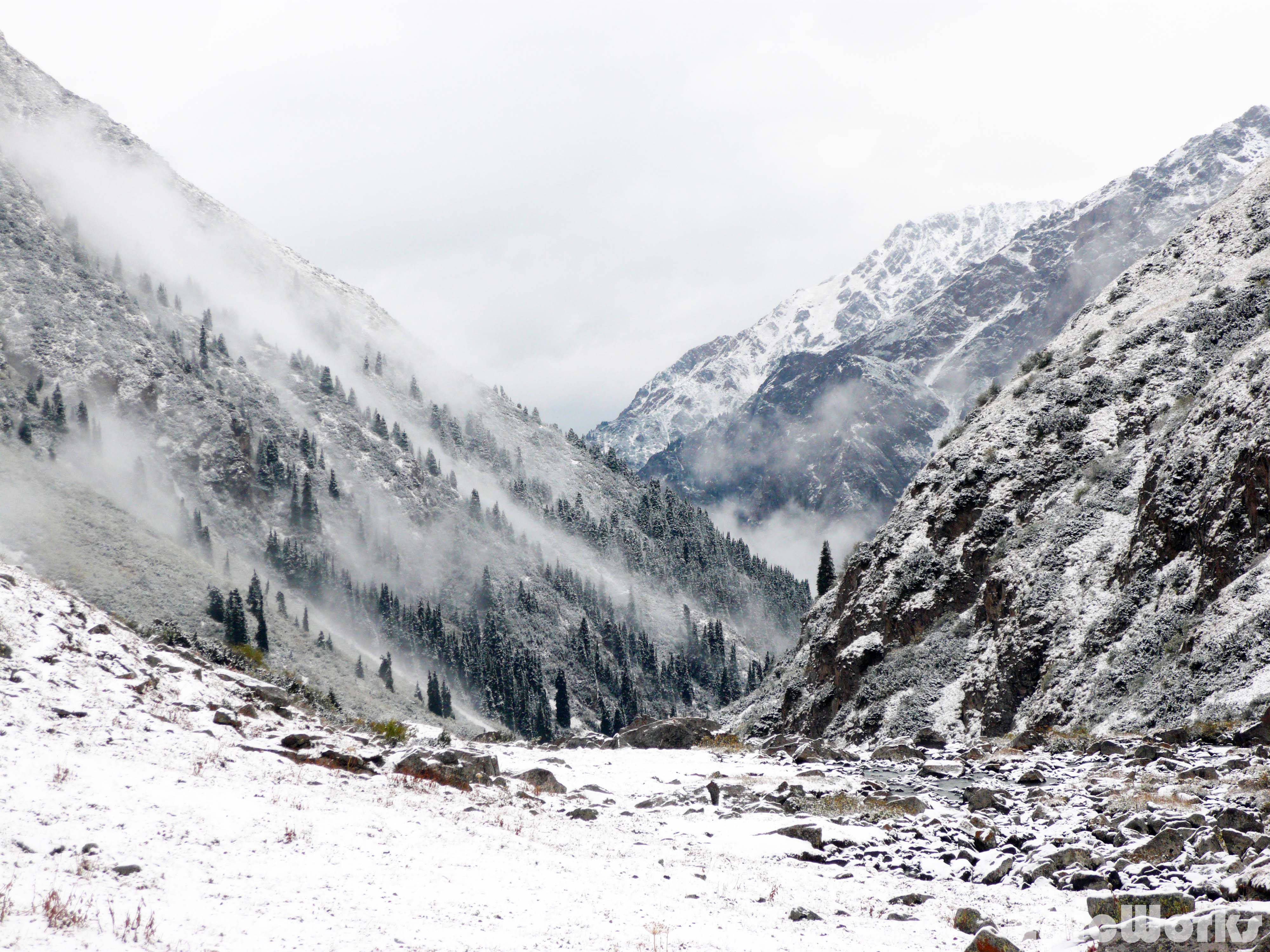
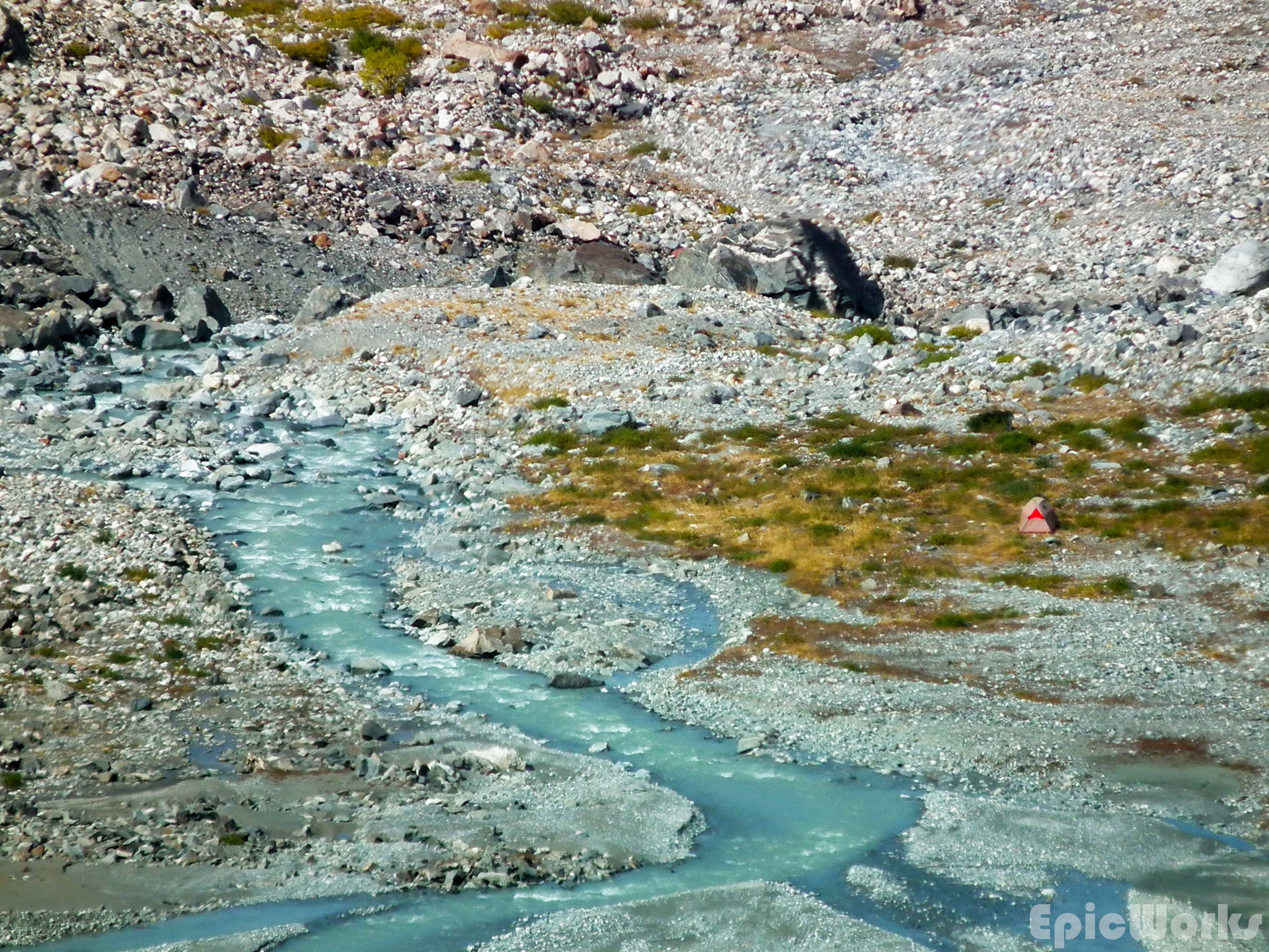
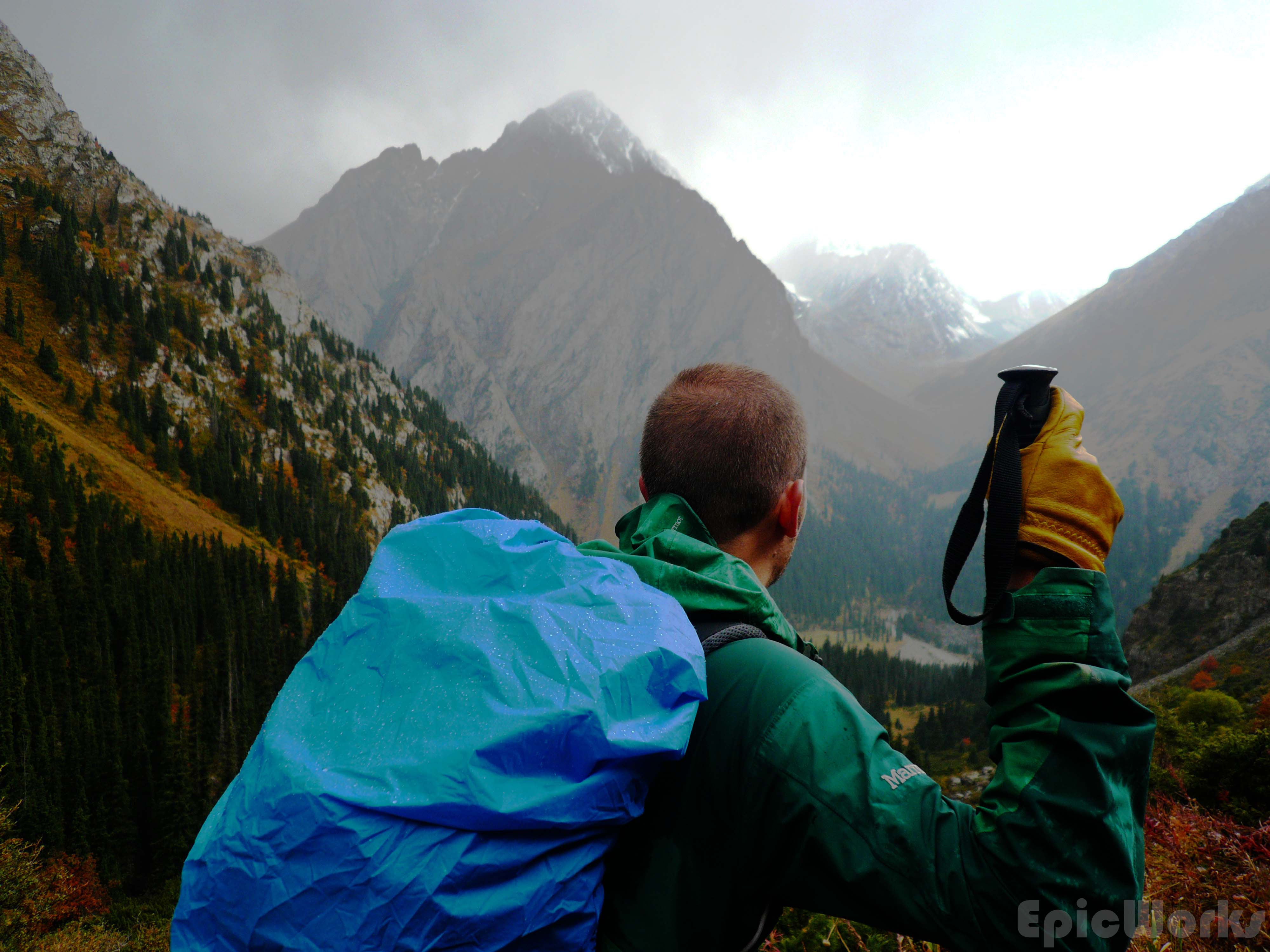
Snow. As I opened the flap next day a chunk fell off the top of our tent. Not much, about 5-10 cm, just enough to cover everything and produce a beautiful effect. We soon ate, packed and set off up the valley. It widens and the path slowly disappears. A large flat flood-plane is criss-crossed with small rivers which we jumped across to keep progressing upwards. The massive peak looked down on us as we got to the end of the plain and started on the crushed rock found at the end of the glacier. We set up our tent and decided to investigate the glacier during the afternoon.
Snow! Everything is white.
It looks down on us as we set off.

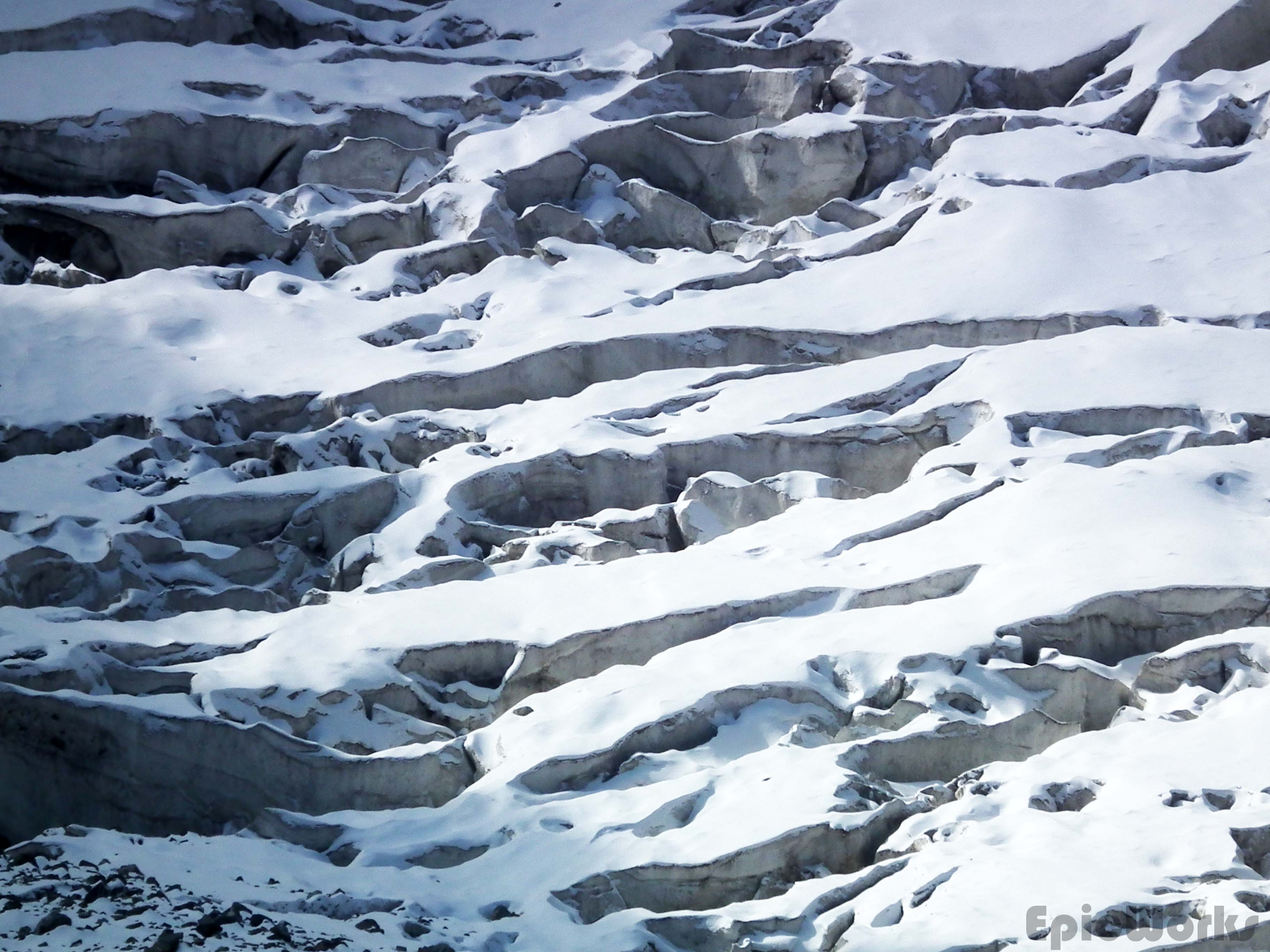
Texture.
Incredible.
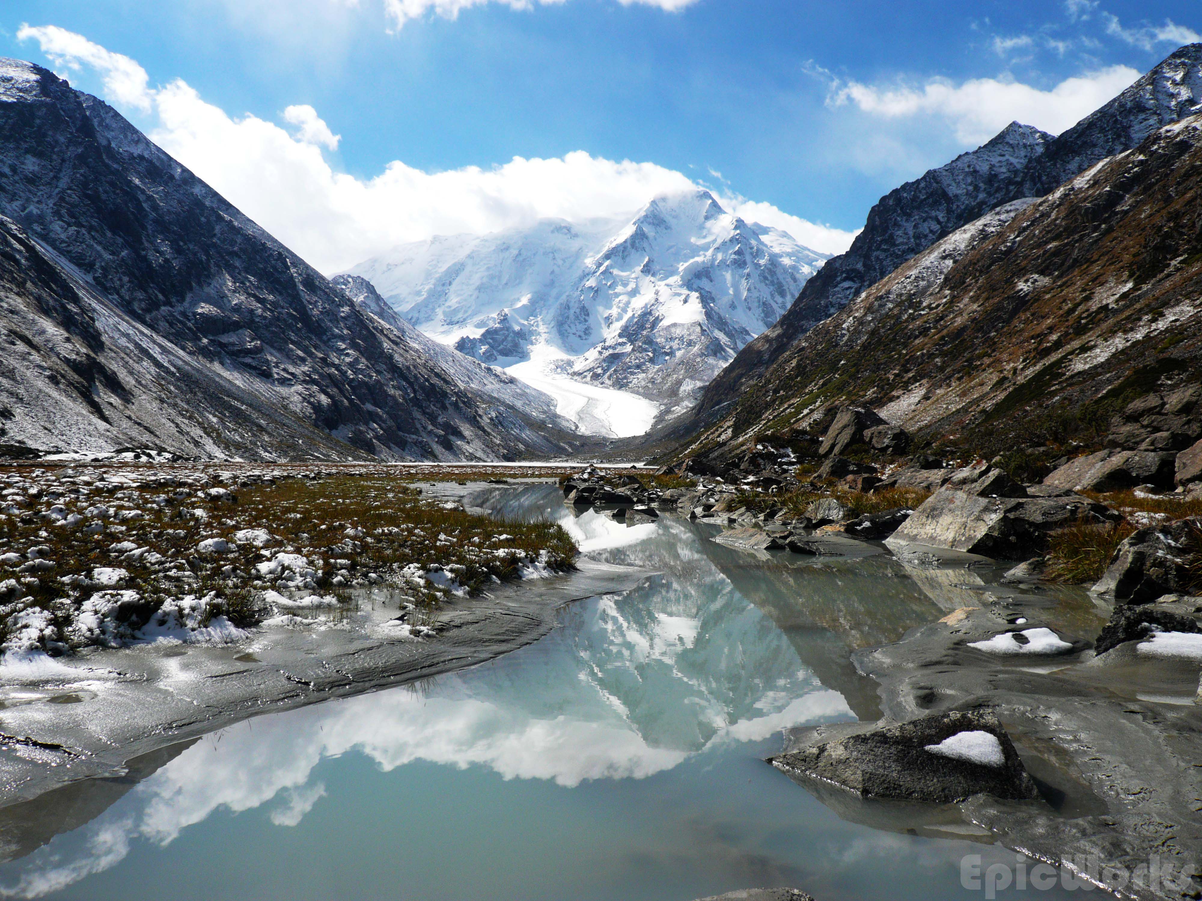
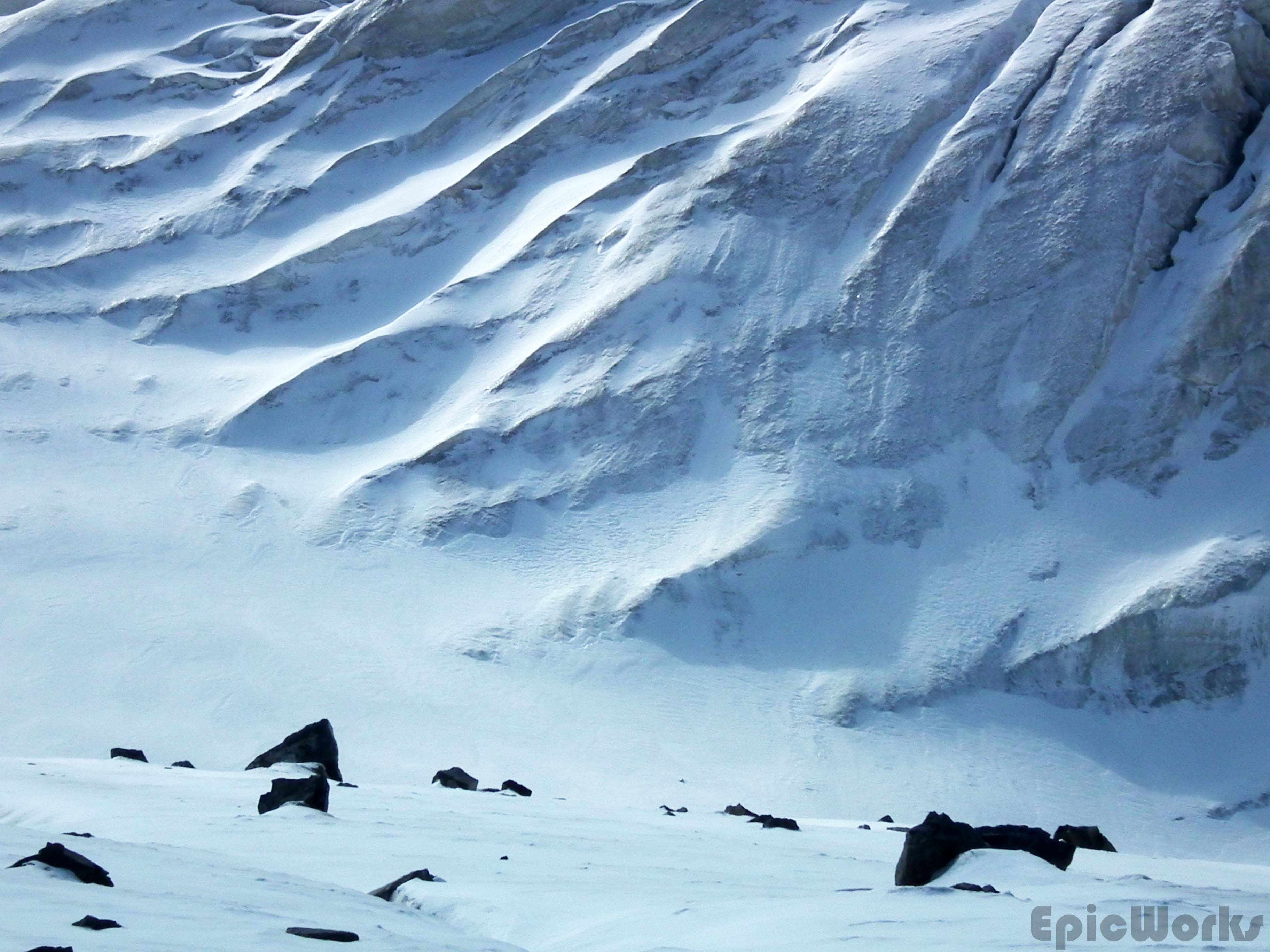
Our first exploration onto the glacier was along its left hand side. The glacier is clearly divided into two parts; a left stone covered side and a completely white side, both separated by a river/crack running down the middle. The right side looked less crevassed, but as we wanted to turn left at the top to head to the col we decided to not risk finding we couldn’t change sides at the top and so chose left. There is so much rock-fall it is hard to tell where the glacier starts, as everything is covered in sand and stone. To try and keep off the main crevassed tongue we stayed far on the left, traversing the slopes above. Once on the slopes we were separated from the central tongue by a river, meaning we could easily get back onto the uncovered part. Heading up we slipped and traversed, the mountains above getting ever bigger. It was slow going and we soon decided this wasn’t the best but we were cut off from the glacier as well as being exposed to falling stones from the steep slopes. Finally at about 3700 we decided to call it a day and as the river had run dry found a passage onto the ice. From here we could see the north face of the impassable col, left of the peak. The views were incredible! We headed down the main glacier, finding the way easy-going. Towards the end it also becomes completely covered in stone, so you would have no idea there is ice beneath. Just at the end, before the serracs that make up the end of the glacier we were able to cross an ice-bridge back to the left bank and get back down to our tent.
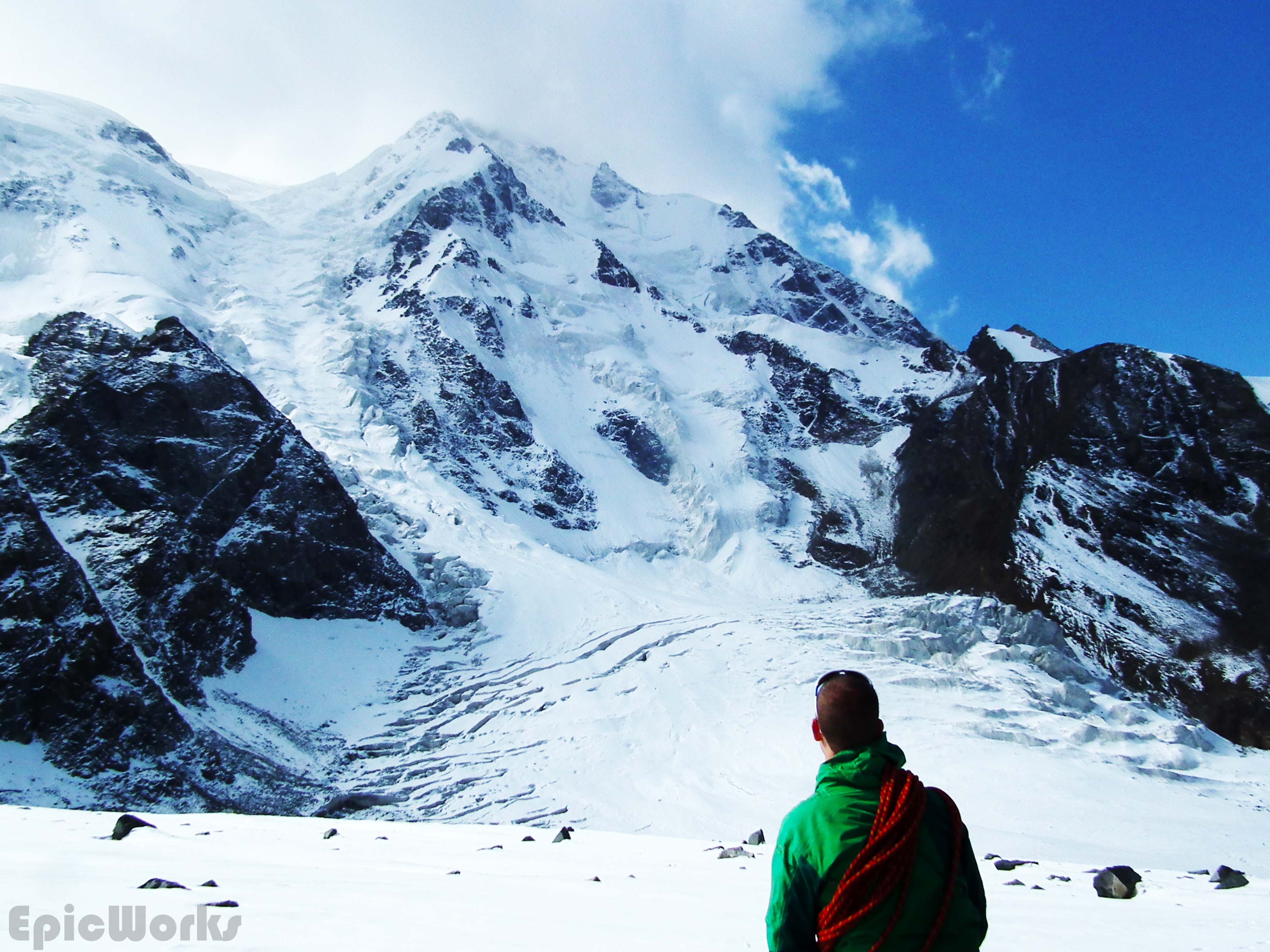
First sight of North Col

Peaks and glaciers
Back down again. What shall we do tomorrow?
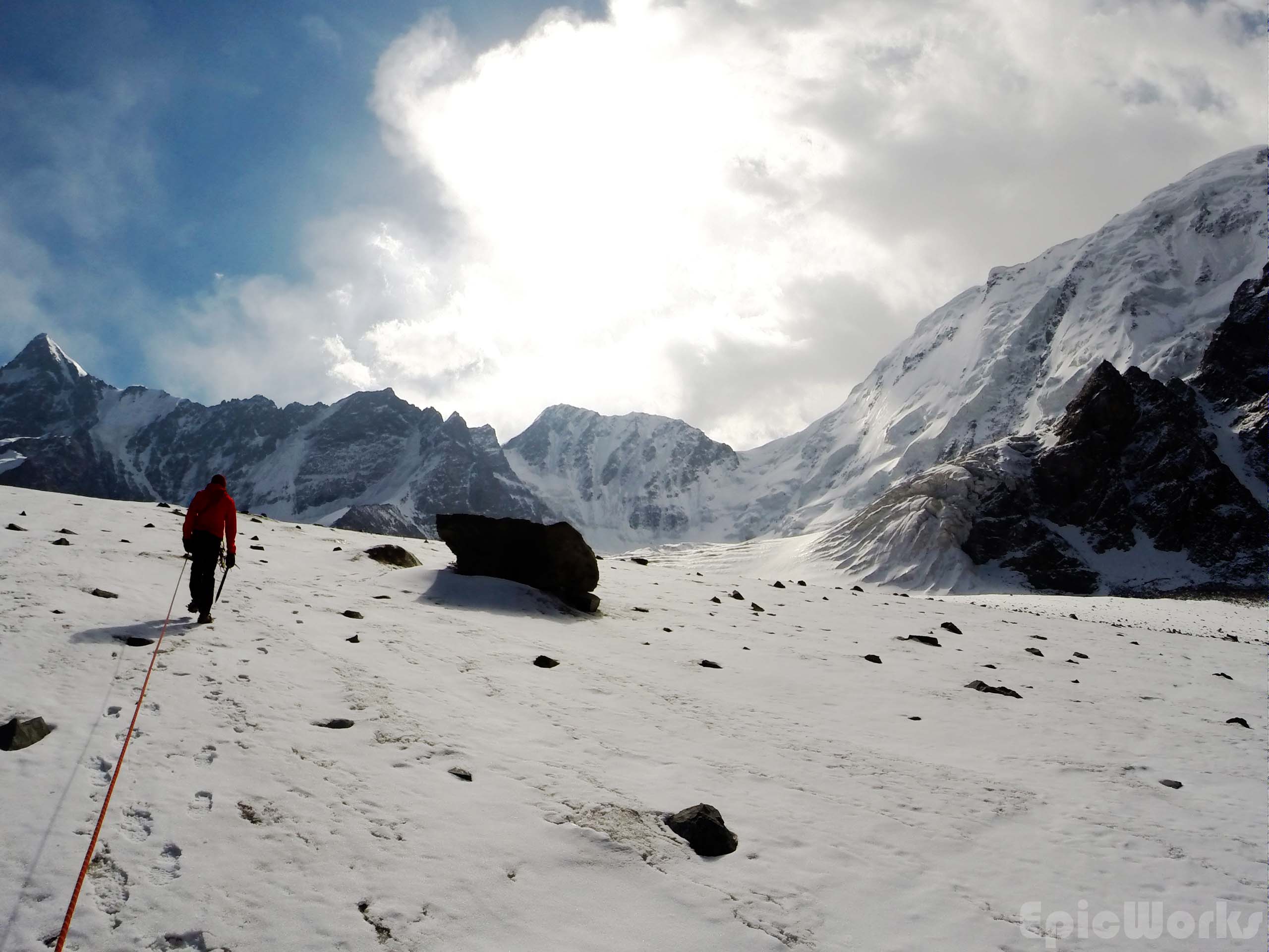
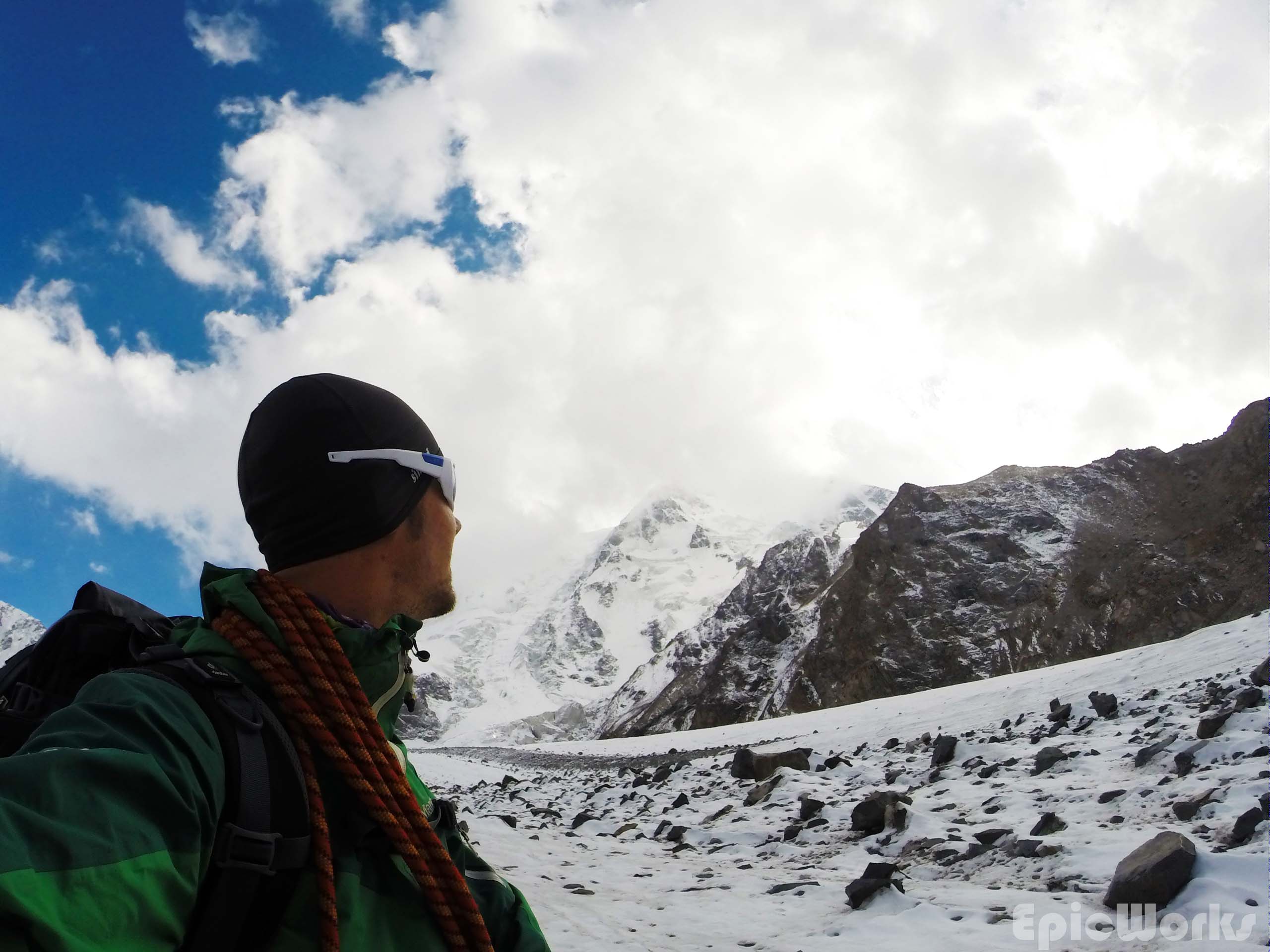
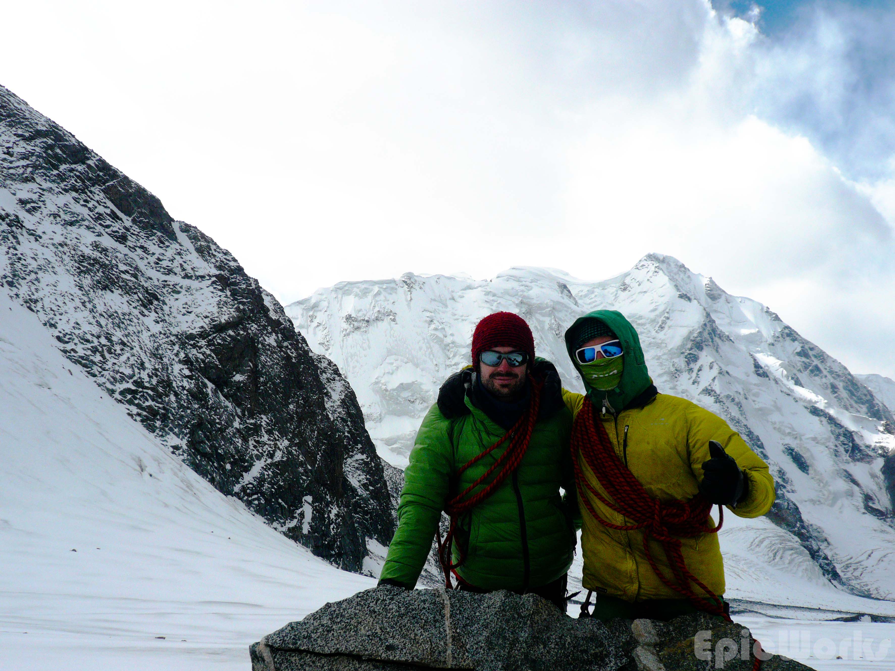
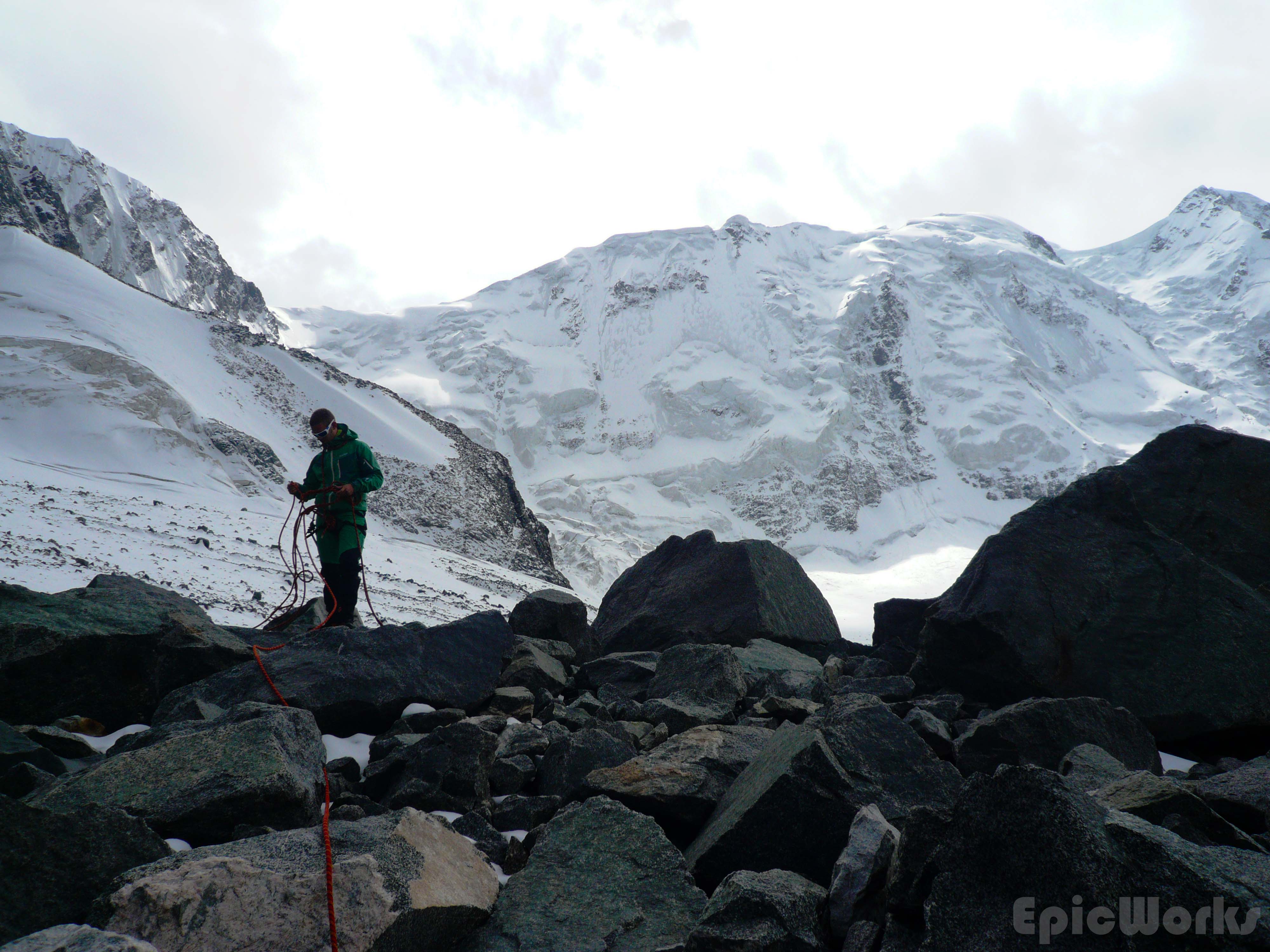
Day 3 and we were supposed to be going as high as possible. Although by this point we had discounted the 4700 m peak we had originally thought about doing due to realistic timetables and no outside communication, we wanted to get the col that separated us from the next valley and hopefully get an idea of the peak. Thomas wasn’t feeling at all good, but still managed to set a good pace up the glacier, following yesterday’s descent. As we got to the place we had started down from we crossed a Russian couple going down. We were quite surprised to see anyone, as we had been told the valley wasn’t visited that much and it was the first people we had seen in two days. The said they had come up the same way. Having said goodbye we continued up, in between the ice and crushed stones. The view of the 5000 peak was astounding, the size of serracs and crushed ice massive. At this altitude (just below 4000) the previous days snow hadn’t melted, and we left powdery footsteps as we went up. After several hours we had passed the north col and almost arrived at our destination. As we approached we could see a fine band of rock separating our valley from the next. Although not too high they cut off the view and passage to the other side. Maybe climbable, it did suppose an important obstacle, so we decided to go no further. After some photographs of the valley and surrounding peaks, we headed down the way we had come, re-crossing the ice-bridge one final time. Thomas was dead by this point, so the we spent the rest of the day resting.
Going up the ice. North Col in background.
The view is captivating.
Crevasse!
Die Nordwand. 5216 m.
Pure Ice.
The way is blocked! Turn-around point.
Rock, ice and rope.
Our valley.
Malinka Palatka!
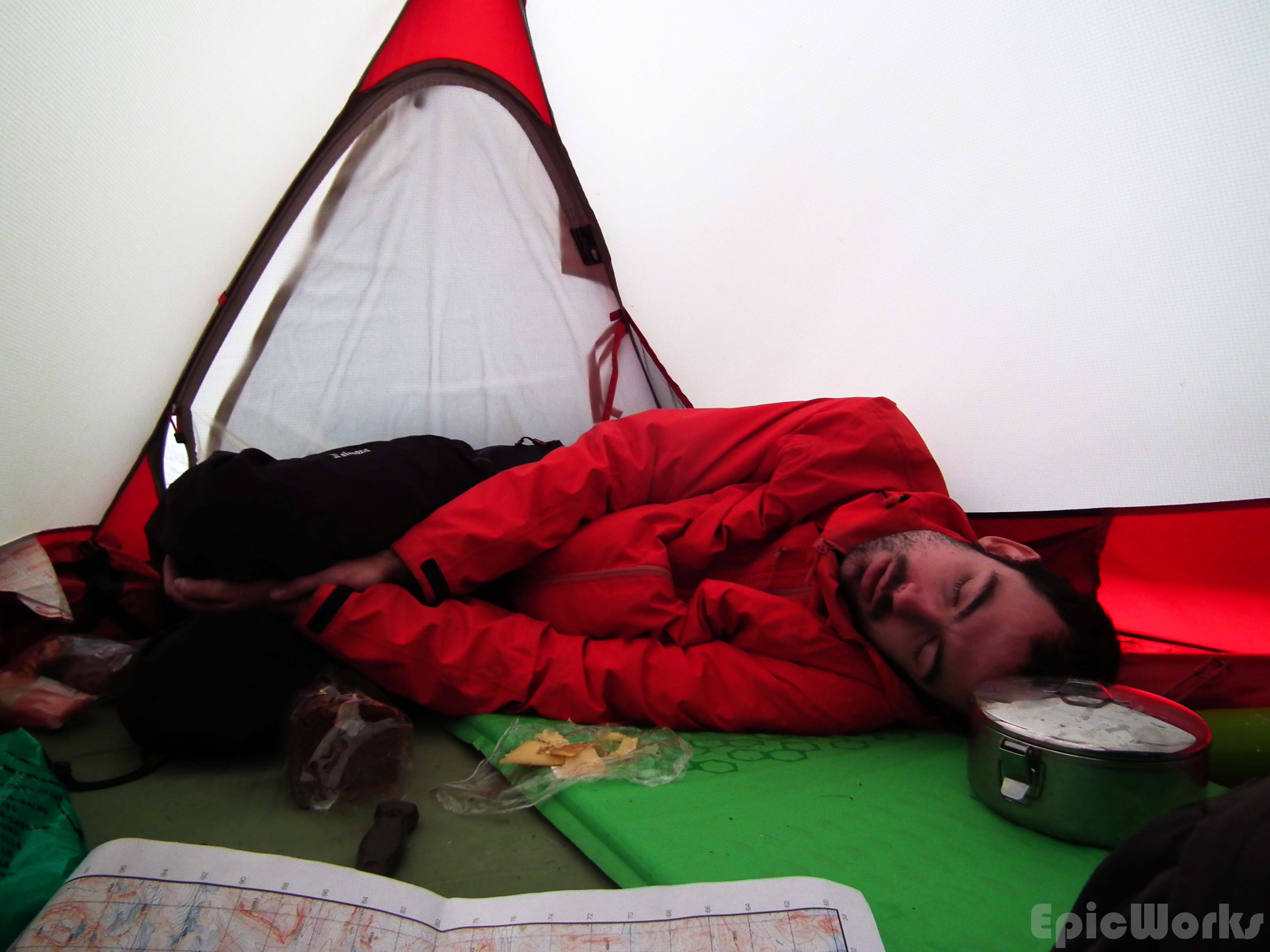
Thomas has given his all. Time to rest.
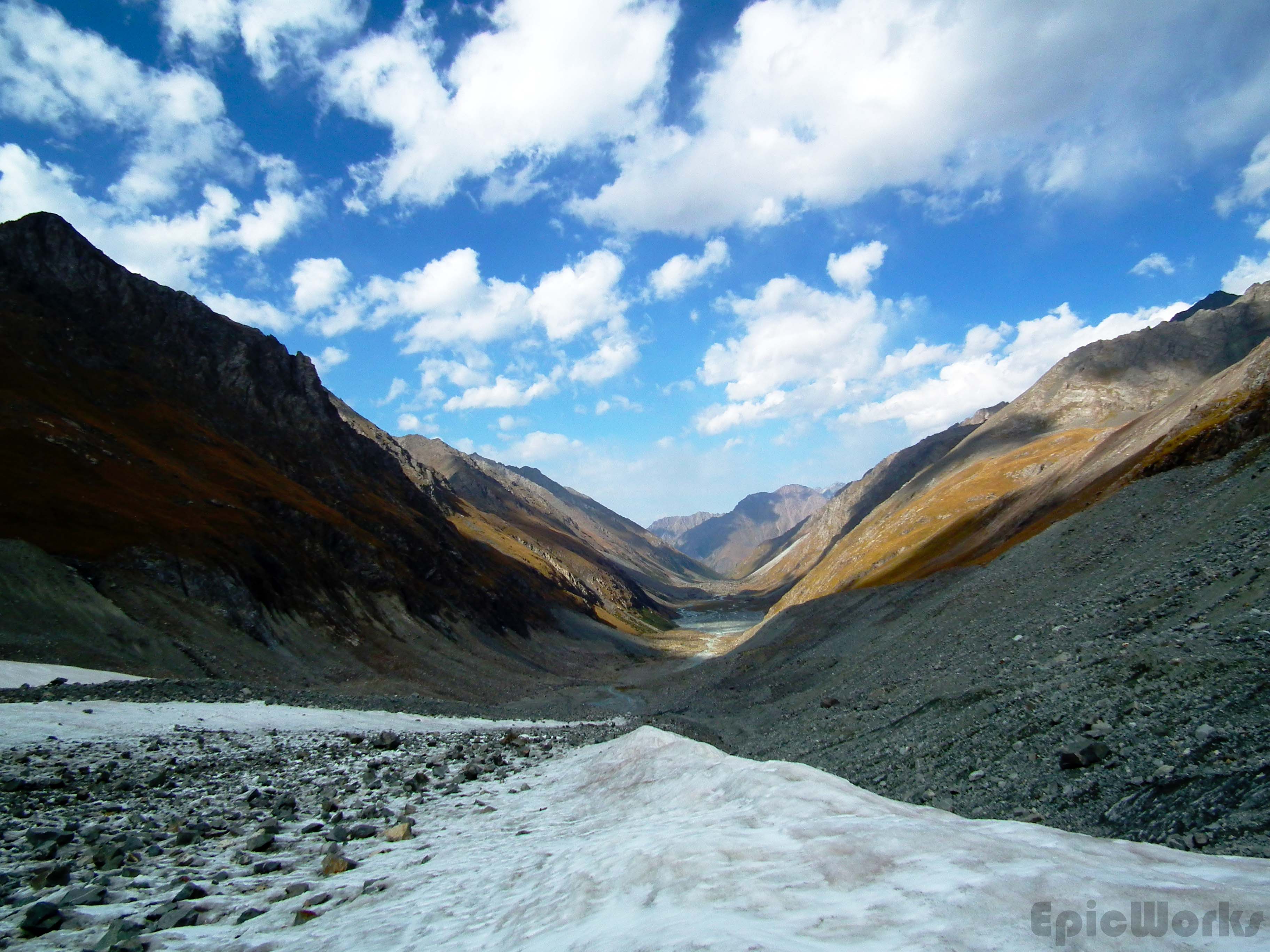
Our final day in the Ala-too was our longest. Having decided we didn’t want to leave without seeing Ala-Kol lake we got up before sunrise and packed up camp. Several hours later we had hiked down the whole valled to the bridge to Ala-Kol. Having crossed we hid most of our kit in the woods to go a bit faster and headed up. We made very good time and in about 3 hours were at the lake. I must say I wasn’t very impressed by the lake; it’s an alpine lake. But the hike up was fun, quite steep in some places and it was good to have a light pack. As by this point we were running really late to get back to Karakol that evening we rushed down and in 2 hours were repacking our bags.
Hiking up towards Ala-Kol

The colours of Ala-Kol Lake.
After the storm. Heading for civilisation.
All that was left was the track that takes you back to town. This is mentioned in several guides as being a day’s hike. We had 3 hours of sunlight left. With no stops, we marched down and down, back through the transformation of mountains to plain. As night fell I felt worse and worse, feeling the blisters grow and pop on my feet. Finally, stumbling with exhaustion we made it to the small village at the foot of the mountain from were we two kids drove us into town. Making our way to the rental shop we had to ring five times before the big Russian opened the door. Telling us it was much too late he still took us in and we managed to give the kit back. When asked about lodging he promptly said he also owned a hostel and showed us the rooms in an adjacent building. So pleased we had sorted everything all that remained was food. A restaurant 5 minutes down the road supplied us with abundant amounts of mutton ribbs, manty, lagman, noodles, beer and coke we made it to bed. Epic.

Boys Toys. View from our hostel room.
Note:
I was slightly disappointed we hadn’t got higher in the mountains and not climbed anything “significant”. The problem was mainly preparation and lack of adaption to our packs as well as timing and sheer distances involved. By the end of the trip we were hiking much faster with the same packs. It’s not the same as knowing the route and just hitting it as fast as you can. A proper expedition should have one, unique goal and just stick to it and keep trying. In our case this wasn’t followed due to timing limitations as well as a desire to see as much as possible, not just climb the highest peak. I’m still just so curious about that 4700s…
Practical information:
You can buy maps from both EcoTrek and CBT but they are more expensive that GeoID (but not much!). Both do treks and organised excursions. We recommend EcoTrek!
You can rent equipment at Extreme Tour Shop, via Igor Khanin. They have basic climbing kit as well as alpine skiis and some mountain clothing and gear for sale. I think I saw shovels and transceivers, probably for sale. I didn’t find anywhere that rents touring skis (EcoTrek has crosscountry).
You can buy camping gas (the screw type) at the sport shop in the centre of town. They open at 10 am weekdays, so try and get it the day before you leave!
Ask for a receipt at the park entrance and when you pay the warden!

Pingback: Kyrgyzstan.Scene IV.Song Kul | Estivill's Epics